Meet ORION
Transform Aerial Data Into Actionable Intelligence
We help governments, utilities, and infrastructure operators make smarter decisions through advanced AI-powered geospatial analytics.
Global Coverage
Satellite and drone data from anywhere on Earth


AI Processing
Advanced ML models for instant insights
AI-Powered Aerial Intelligence for Critical Decisions
We transform satellite, drone, and sensor data into actionable insights that protect infrastructure, detect threats, and enable faster response times.


What We Solve
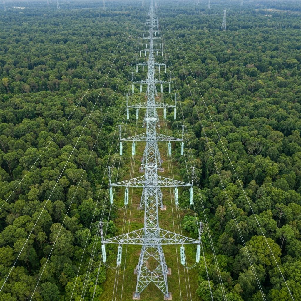
Utilities & Grid
Vegetation encroachment, asset inspection, and corridor monitoring for TSO/DSO operators.
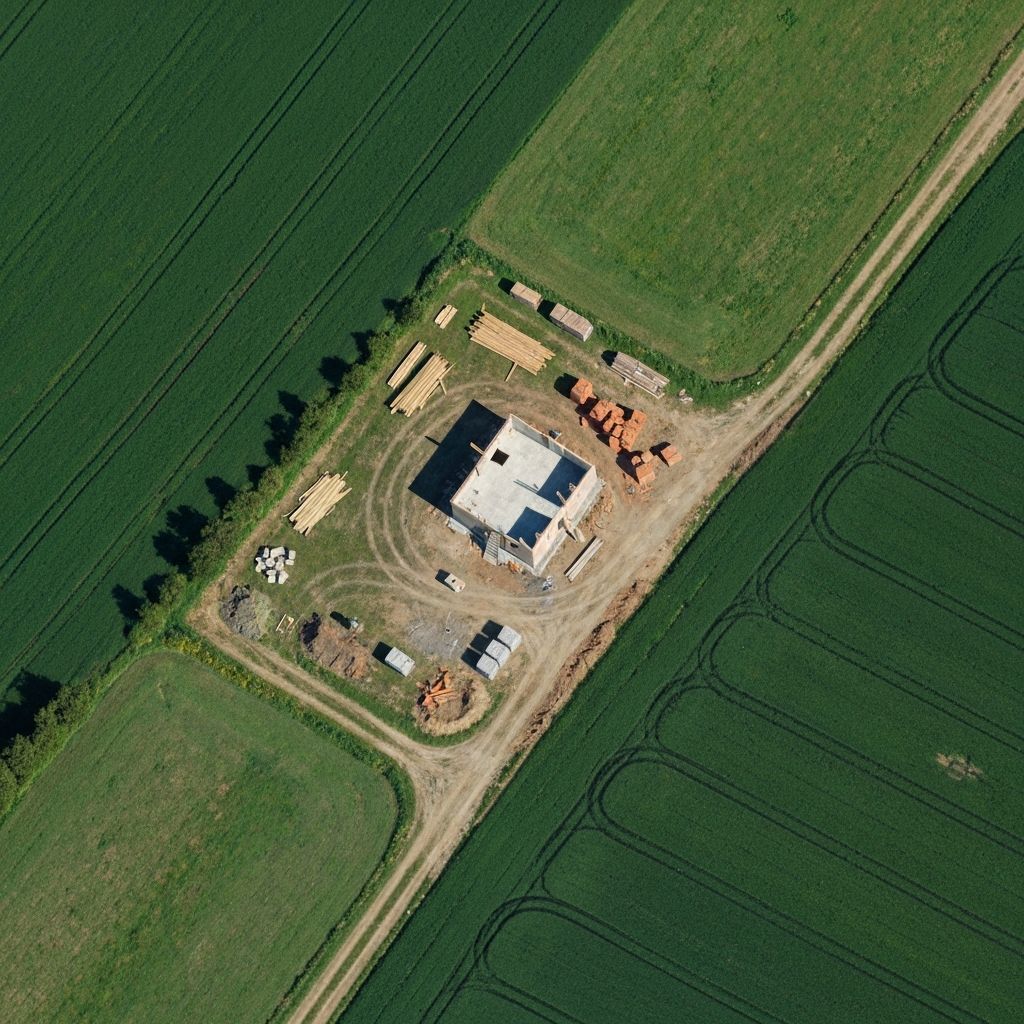
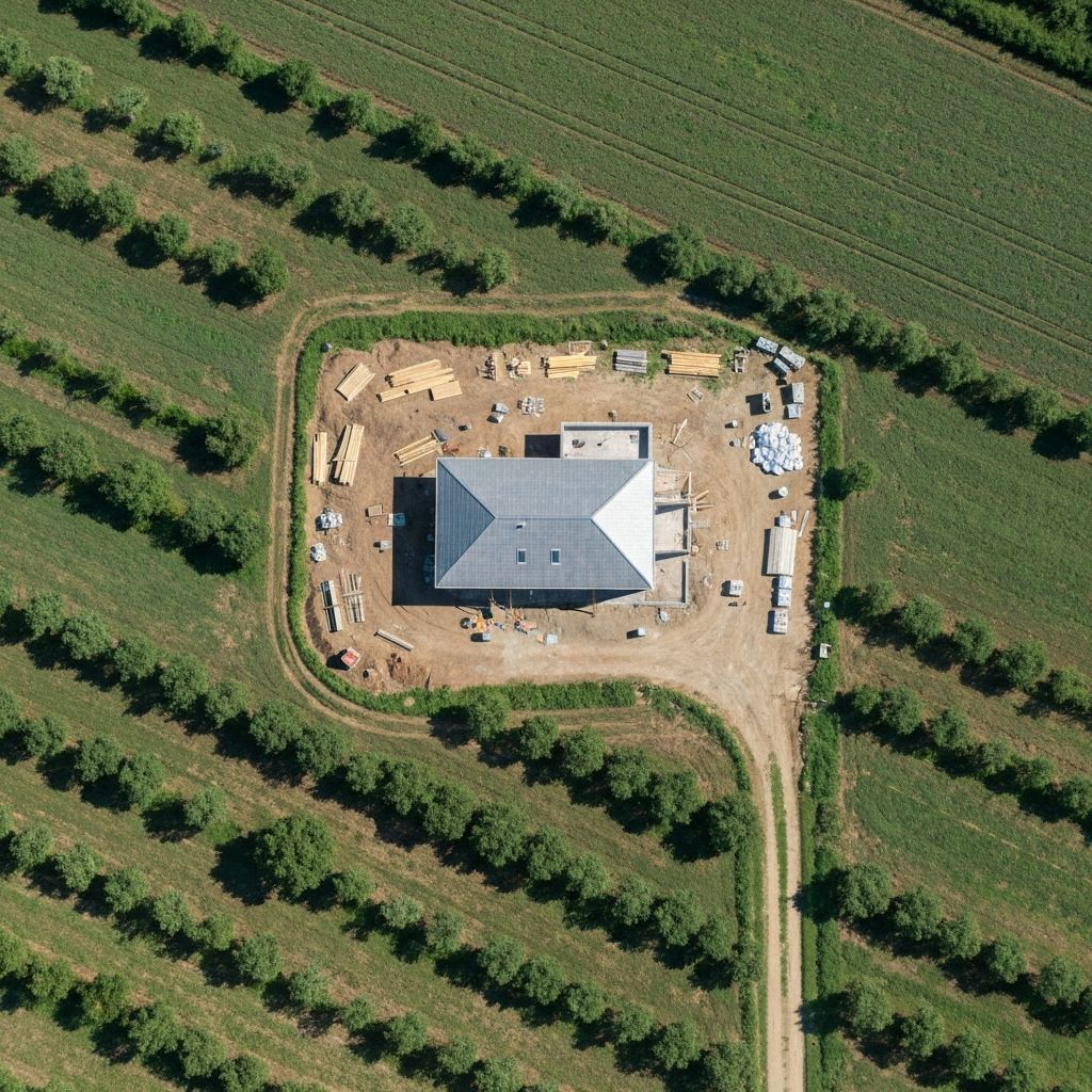
Illegal Construction
Automated detection of unauthorized building activities with evidential documentation.
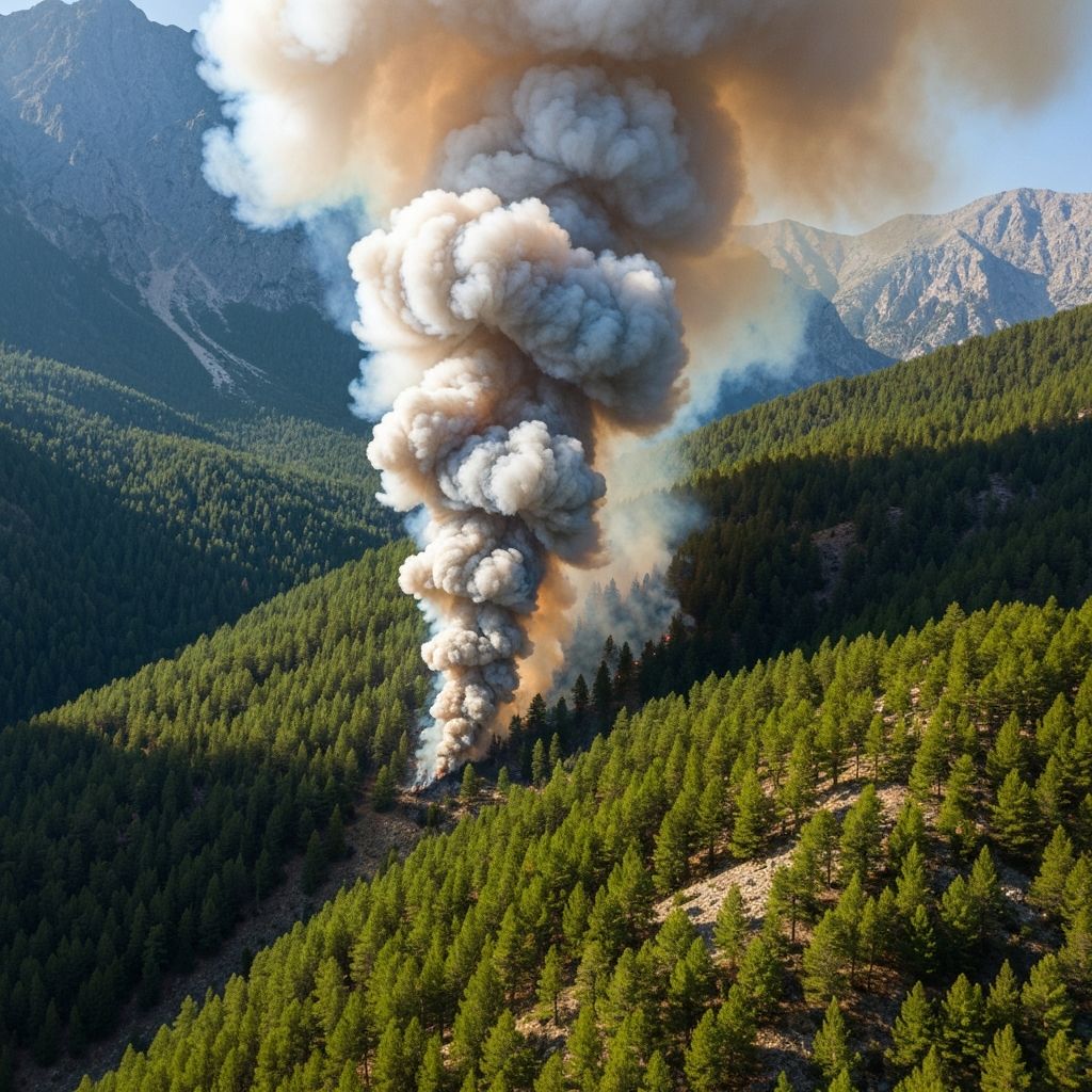
Fire Detection
Real-time thermal monitoring and early warning systems for wildfire prevention.
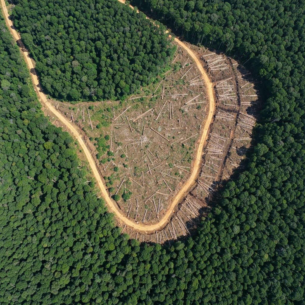
Illegal Logging
Deforestation monitoring and predictive analytics for forest protection.
End-to-End Geospatial Intelligence
Our core capability is turning raw aerial and remote-sensing data into actionable intelligence through a comprehensive four-step process.
Data Capture
From Above
We collect multi-modal data from UAVs/Drones (RGB imagery, LiDAR, thermal, multispectral), high-precision satellite imagery for continuous wide-area monitoring, and fixed towers & ground sensors for persistent observation in high-risk zones.

Centralized Collection
& Integration
All data streams are ingested into a central platform, aligned spatially and temporally, and enriched with contextual data including GIS layers, asset registries, weather, and terrain information.

AI-Based Processing
& Analytics
We apply AI/ML and computer vision for image & video analysis, LiDAR point-cloud processing, thermal and spectral signal interpretation, and sensor data fusion to automatically detect, classify, predict, and alert.

Visualization
& Decision Support
Results are delivered via interactive maps, dashboards, real-time alerts, and APIs, ready for operational use and regulatory evidence gathering.

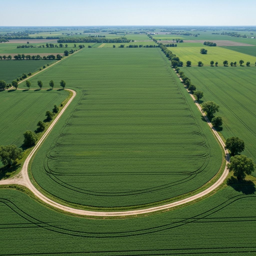
Temporal Change Detection
We capture images at different moments in time, compare them to detect relevant differences, eliminate false positives, and narrow down critical areas requiring immediate attention.
Multi-Temporal Capture
We acquire imagery of the same location at different points in time - days, weeks, or months apart - creating a temporal dataset for analysis.
Pixel-Level Comparison
Our AI compares images pixel by pixel, identifying any changes in the landscape - new structures, vegetation loss, thermal anomalies, and more.
False Positive Elimination
Smart filtering removes irrelevant changes: shadows, seasonal variations, cloud cover, and temporary objects to focus on what truly matters.
Critical Area Narrowing
The system pinpoints exact locations requiring attention, prioritized by severity, enabling rapid and targeted response.
See It In Action
Drag the slider to compare before and after imagery
New structure identified
AI confidence: 97.3%
Analysis Pipeline:
Utilities Predictive Maintenance
For Transmission System Operators (TSOs) and Distribution System Operators (DSOs), we provide comprehensive monitoring and predictive maintenance solutions that transform infrastructure management.
Power Line Inspection
Vegetation encroachment, sagging, damaged components detection
Asset Condition Assessment
Using LiDAR + imagery for comprehensive infrastructure analysis
Predictive Maintenance
AI-powered planning and risk prioritization before failures occur
Optimized Operations
Reduced outages, improved safety, and significant OPEX savings
Illegal Construction Detection
Automated detection and monitoring of unauthorized building activities using satellite and drone imagery with AI-powered change detection.
- Continuous satellite monitoring to detect new structures
- Drone-based high-precision verification where legal or evidential accuracy is required
- Time-based change detection for enforcement workflows
- Automated reporting and evidence documentation
Fire Detection & Early Warning
Real-time thermal and optical monitoring for wildfire prevention and rapid response in high-risk areas and corridors.
- Tower-based optical and thermal detection in high-risk forest areas
- Sensor coverage along risk corridors (roads, power lines, settlements)
- Early alerts to minimize response time and damage
- Integration with emergency response systems
Illegal Logging Detection & Forecasting
Advanced deforestation monitoring and predictive analytics for proactive forest protection and environmental compliance.
- Detection of unauthorized deforestation from satellite imagery
- Pattern analysis and risk forecasting for proactive enforcement
- Long-term environmental monitoring and reporting
- Carbon credit verification support